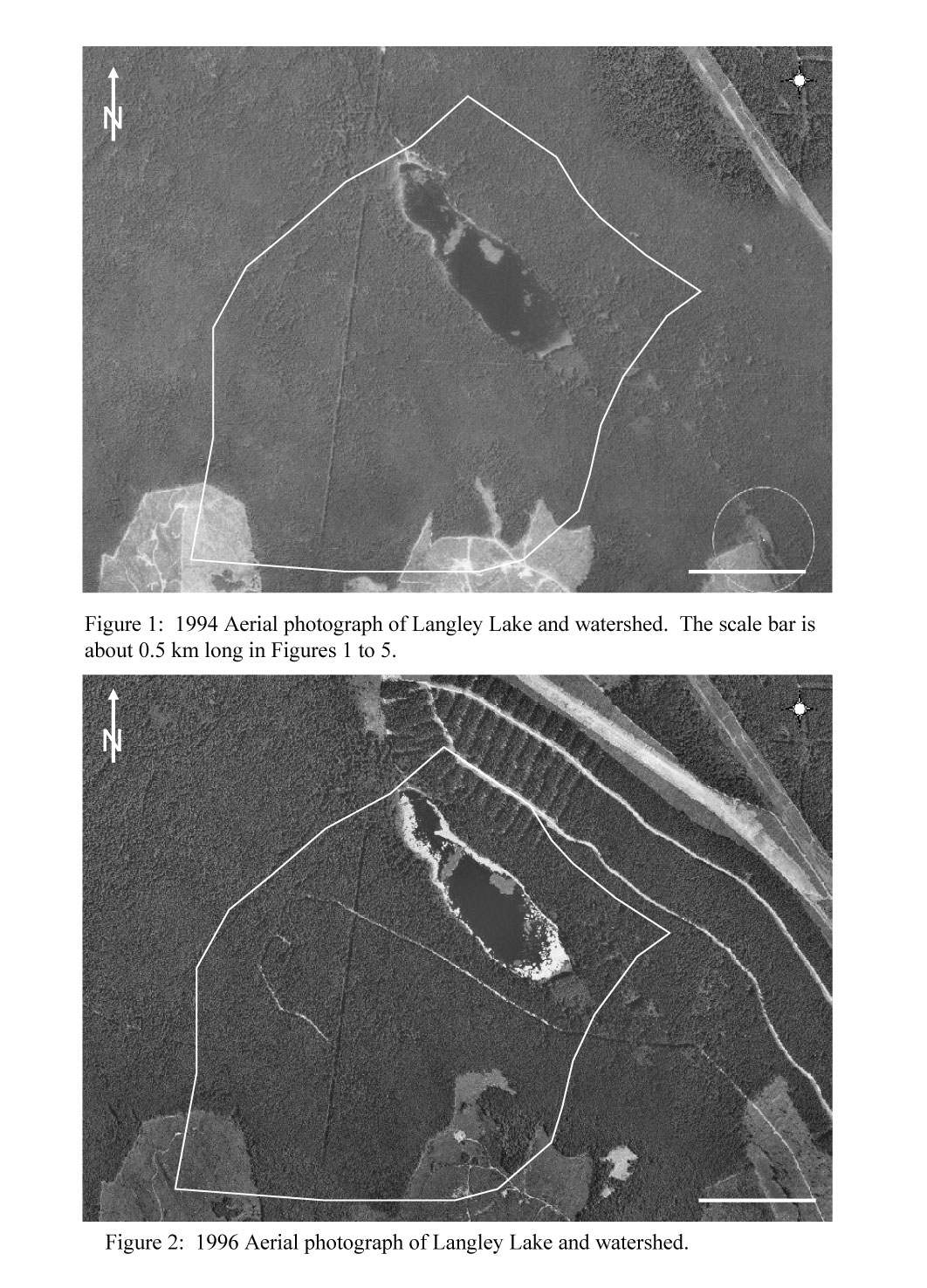
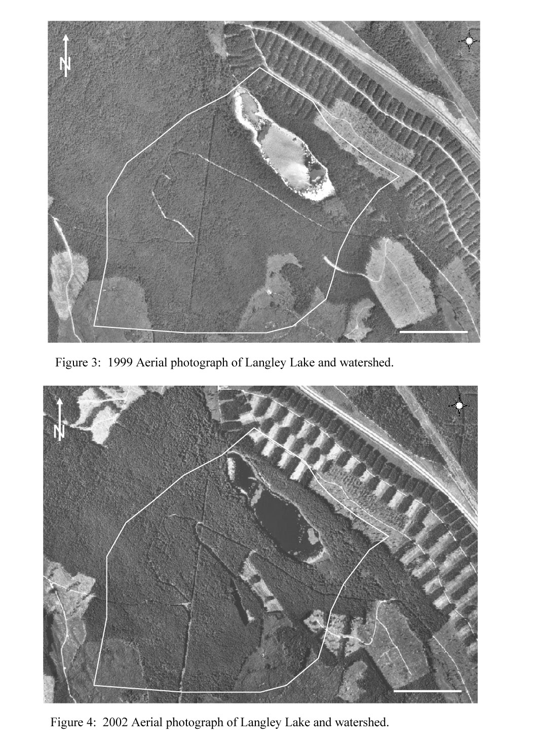
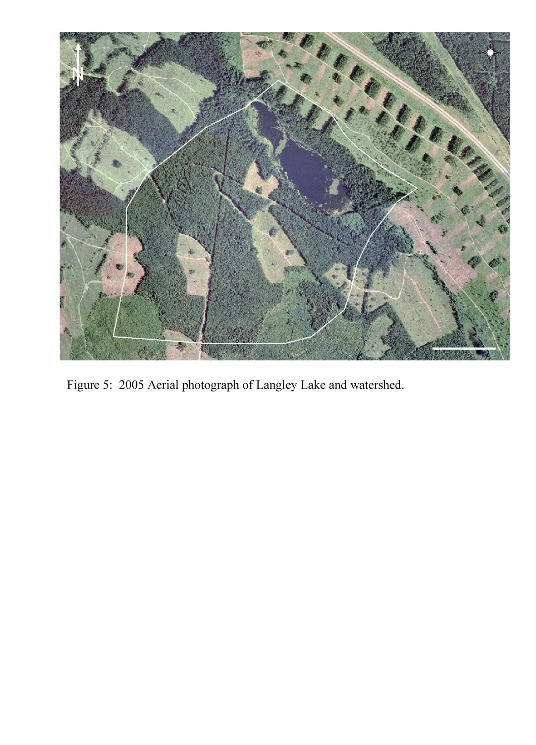
Another wonderful landowner sent me the following. The white line is our watershed. It’s shocking to see up until 2005 – almost 13 years ago. Imagine what it looks like now?
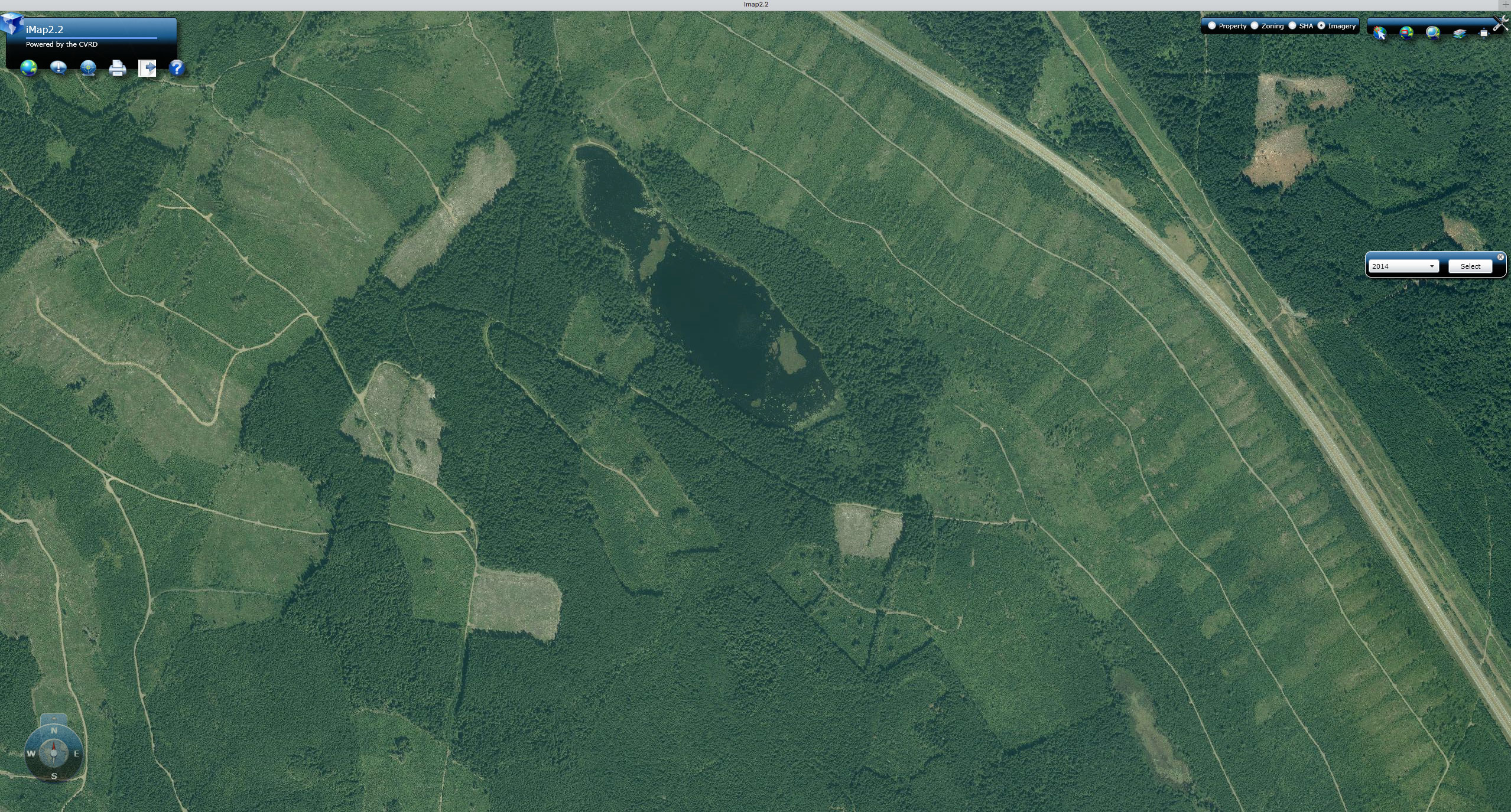
This is a screenshot I took today from iMap on the CVRD website and the image is from 2014.